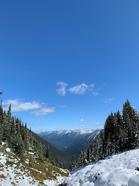
Hiked: 01 October 2019
Distance: 9 miles
Elevation Gain: 2,300 ft
Trailhead: Frying Pan Creek on Sunrise Park Rd
Difficulty: Moderate
 |
| Mt. Rainier isn't the only peak to gawk at on the hike to Summerland |
While the Wonderland Trail circumnavigates the entirety of Mt. Rainier and takes days (or weeks) to hike, there are lots of segments that can be tacked in a day and still offer incredible views. The Summerland trail follows along the Wonderland Trail up 4. 5 miles to Summerland Camp, a primitive campground for backpackers.
After making the drive from Kirkland to Mt. Rainier, I set out for Summerland on the first day of October. I knew it had snowed in the park a few days earlier, but I wasn't quite sure the extent of it. When I first arrived, Sunrise Park Rd was closed due to the snow, except for the first five miles. Luckily, the trailhead to Summerland is only about 4 miles up the road. I arrived around 10:30 a.m. and the parking lot for the trailhead was full, but I was able to find a little space in between cars to park my Mini Cooper.
The first three miles of the hike is covered in towering evergreens and climbs gently, but steadily. I ran into a few fellow hikers, but not too many. I find that I like to see the presence of other people every once in a while when I'm hiking solo. It provides affirmation that I'm on a well-known trail, as well as reassurance that if something bad happen, it wouldn't be too long before someone would come along to witness it. This hike had the perfect number of people.
 |
| Snow flurries began in higher elevations |
There are several stream crossings that were made a little tricky since the stepping stones had frozen. The trail froze over in places in the last 1.5 miles of the ascent, and while this didn't prove to be an issue while climbing up, it did lead to a few slips on the descent. A pair of microspikes or even just trekking poles could have made the return a little easier.
 |
| After some hiking traffic, some bridges turn into more of ice slides |
 |
| Giant evergreens tower over the river that cuts its way through the park |
Eventually, the trees thin and afford views of Mt. Rainier and surrounding peaks. The scenery is truly breathtaking and really makes the area live up to its designation as a National Park. By the time I began my final approach to the camp, the snow had become so deep that I would have had difficulty finding the trail if not for the boot tracks of hikers who had already made the trek.
 |
| The glaciers of Mt. Rainier become apparent in the last mile of the ascent |
 |
| Signs direct hikers to stay on the trail and lead to the camp |
The Summerland Camp consists a few campsites, a group site, and a couple pit toilets. I checked out the camp and then continued up the trail a bit to find a place to sit and eat lunch. About a quarter mile from the camp, I found a rock with a view of the Sourdough mountains and small waterfalls in the distance. There's supposed to be a glacial lake another half mile from this point, but the trail grew steeper and I wasn't confident in the tread on my boots. After my lunch, I headed back down the way I came up, taking in even more views I had missed out on while hiking up.
 |
| Views of Sourdough Mountain range from the Summerland Camp |
Overall, the hike to Summerland is long, gentle, and offers panoramic views of Mt. Rainier and surrounding streams, mountains, and meadows. While a little technical in the winter, this would be easy and beautiful in the summer (especially in wildflower season!) This is a great 1/2 day hike and should be supplemented with a drive up to the Sunrise Visitor's Center.


Comments
Post a Comment